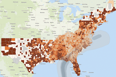
The iParametrics Critical Infrastructure Analyzer now provides emergency management and recovery planners with a system to rapidly examine the potential impact of various kinds of risk events (flooding, tornados, ice and snow, drought, hurricanes, crime, etc.) on key critical infrastructure locations in given geographic areas. This opens up a new dimension of planning and response flexibility and accuracy.
Use Cases
Emergency Planner
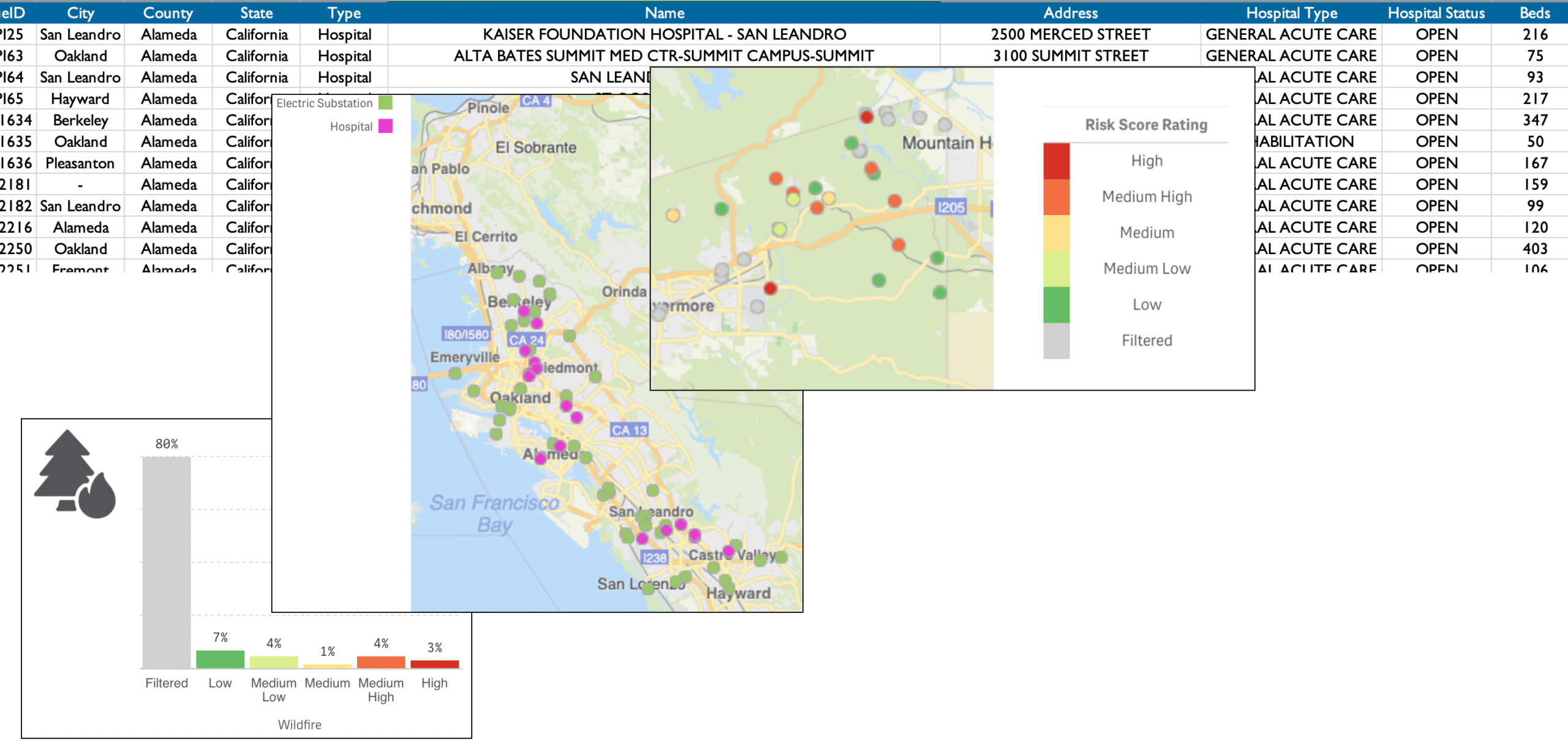
An emergency planner, responding to a pandemic, needs to be able to identify all of the hospitals in an affected area and their capacity to accommodate an influx of new patients. But the planners also need to understand the risks to those hospitals from seasonal wildfires. This includes not only the direct risks, but contingent risks, such as risks to the power stations that supply the hospital power.
City Planning Commission
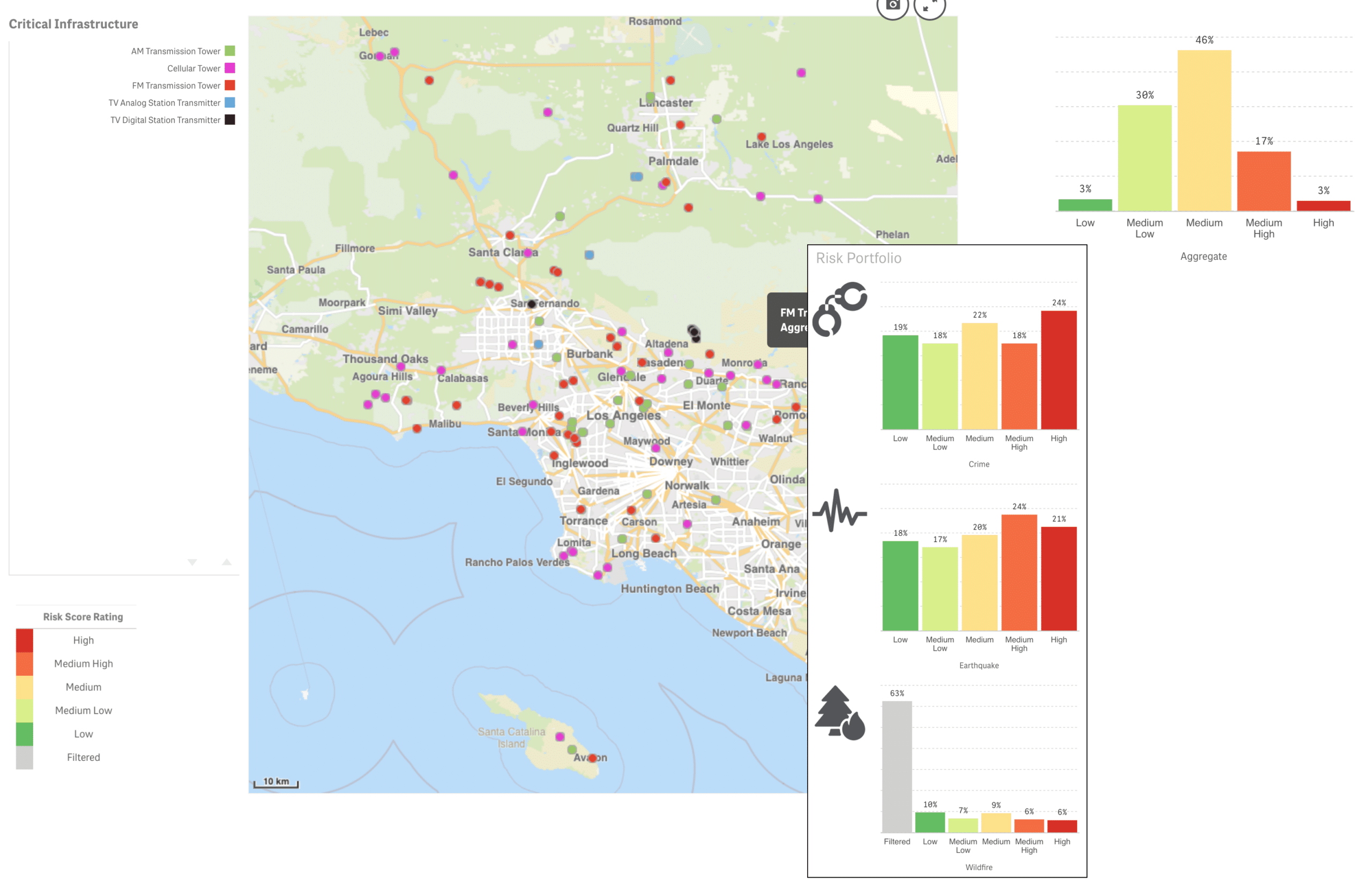
A city planning commission needs to better understand the total vulnerability of its communications infrastructure in order to properly budget for and prioritize capital improvements.
Major Corporation
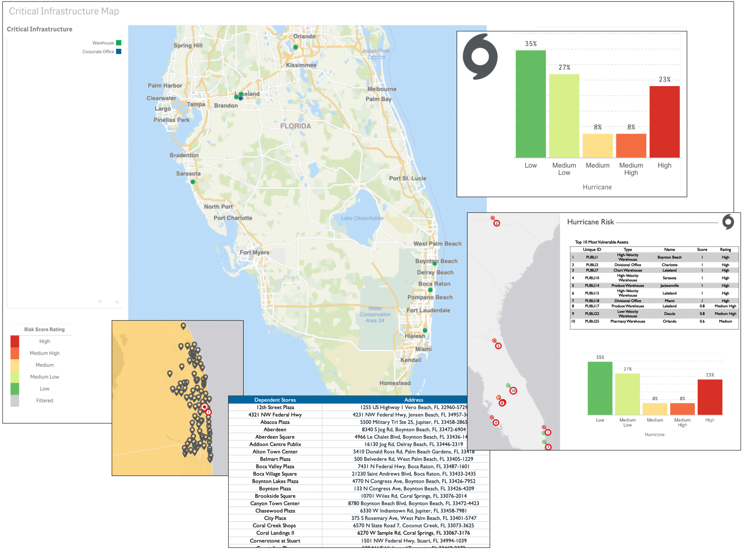
A major corporation needs to understand comprehensively the potential effect on its business from hurricanes. It needs to be able to map and evaluate all of its potentially affected corporate offices, and its entire logistics chain, from its warehouses down to the retail store level.
County Security Manager
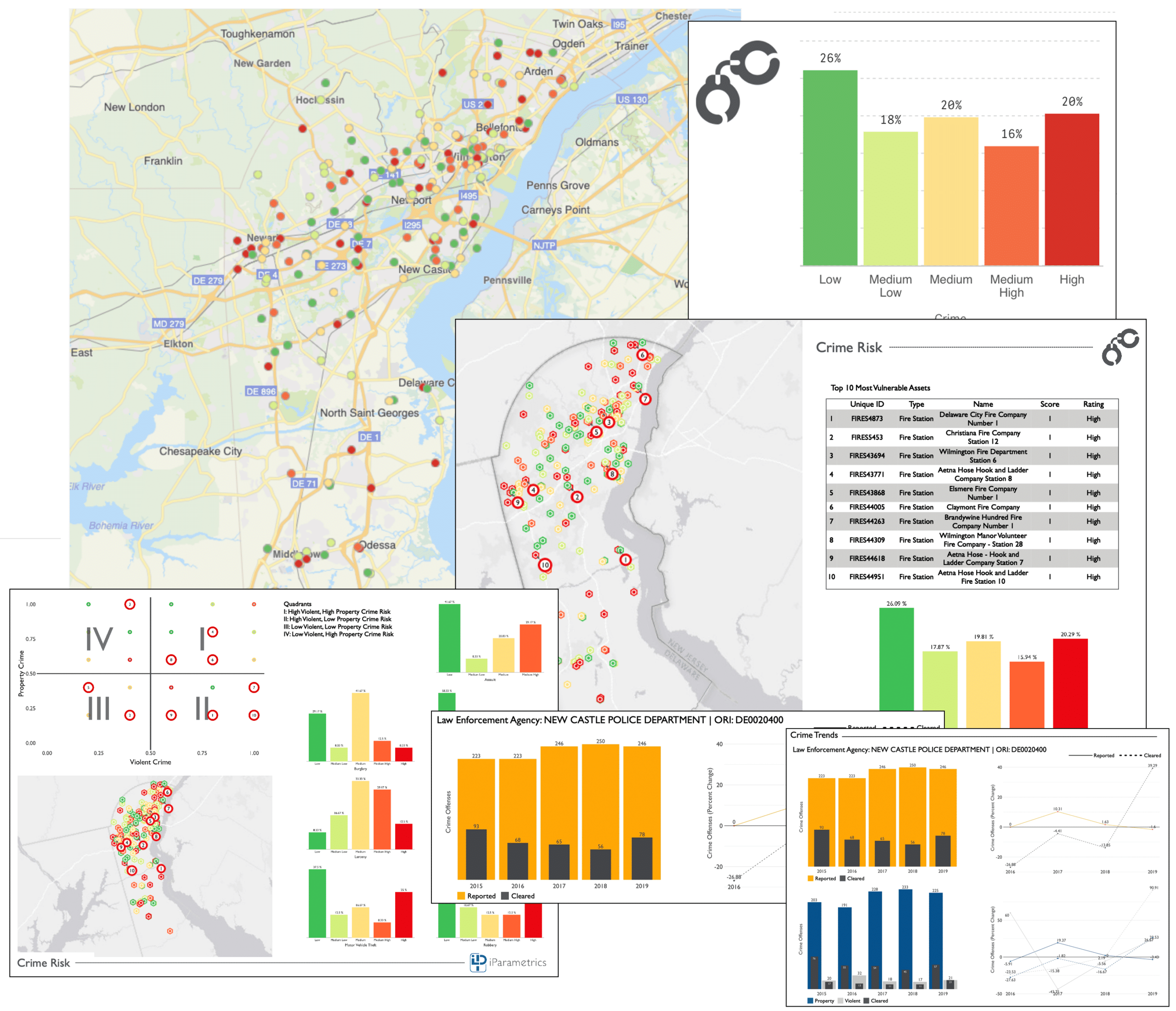
A County wishes to evaluate the risk of criminal activity on all of its County-owned properties and buildings.
Major Benefits
Key Features
- Over 4.5 million critical infrastructure points pre-loaded.
- Ability to easily include customer-specific locations and geographic target regions.
- A dozen different hazard types pre-loaded, including natural hazards and human hazards (e.g. crime).
- Shows composite risk of combined effects of multiple hazards.
- Takes into account “contingent” infrastructure risk, for example, the dependency of a water pumping station on a power station.
- Geographical selection by State, County, City or any customer-specific geography.
- High quality, professional graphics can be included directly in presentations and documents.
- Detailed, tabular, “operational” reports provide exact locations, and building characteristics, for example reports out location of all of the hospitals in a target city and the number of beds in each.
Video Demo
Watch this video walkthrough of the Critical Infrastructure Analyzer in detail.