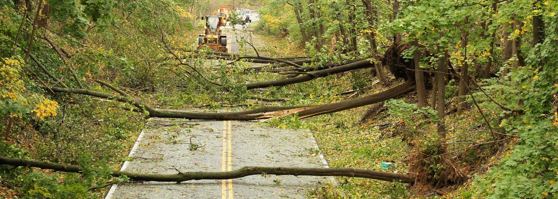
President Biden has approved more than $3.46 billion to increase resilience to the impacts of climate change nationwide. This significant investment is now available for natural hazard mitigation measures across the 59 major disaster declarations issued due to the COVID-19 global pandemic through the Hazard Mitigation Grant Program.
Every state, tribe, and territory that received a major disaster declaration in response to the COVID-19 pandemic will be eligible to receive 4% of those disaster costs to invest in mitigation projects that reduce risks from natural disasters. This influx of funding will help communities prioritize mitigation needs for a more resilient future, including underserved communities that are most vulnerable to the impacts of climate change. These projects can help address effects of climate change and other unmet mitigation needs, including using funds to promote equitable outcomes in underserved communities.
Mitigation projects can include:
- The use of nature-based features, such as storm water parks, living shorelines, and land conservation to reduce coastal erosion or increased flooding.
- The creation of buffers to decrease spread and absorb impacts of approaching wildfires using fire resistant construction materials.
- Relocating critical utilities outside of high-risk areas.
Eligible applicants include:
- State and local governments who have an approved Local Mitigation Strategy (LMS) in accordance with 44 CFR §201.6, prior to receipt of HMGP subgrant funding for projects
- Private non-profit organizations or institutions that own or operate a private nonprofit facility as defined in §206.221(e)
How Can We Support You?
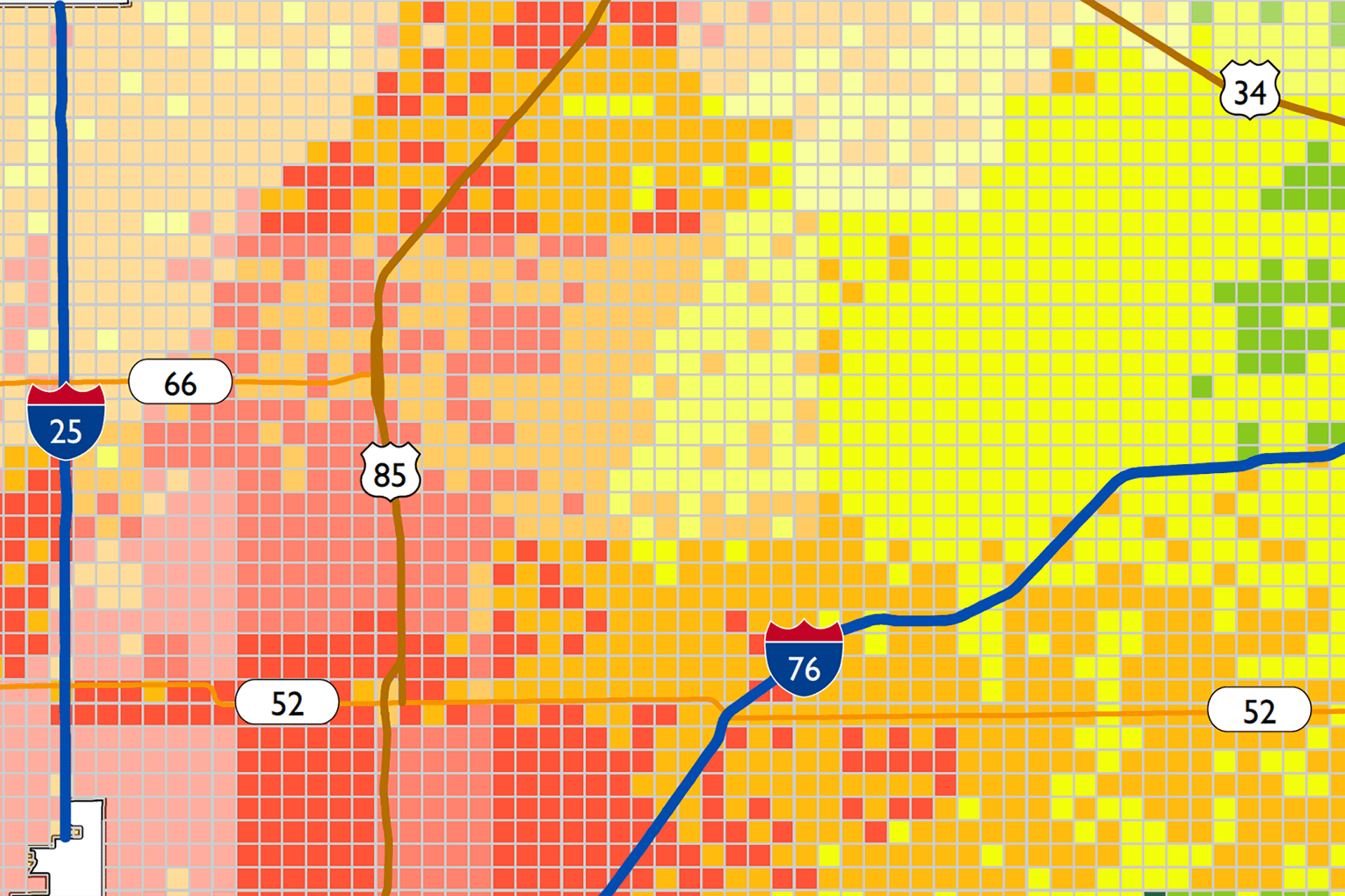
iParametrics can help you use data science to drive better decision making as we did in Weld County, Colorado in 2020. We assisted the County with incorporating analytics into their updated Hazard Mitigation plan by developing a geospatial model to execute the risk identification component of the HMP. This included gathering and analyzing data from over 15 different state and federal datasets to represent the nine hazard types of highest concern to the County such as severe storms, wildfires, hazardous material, and public health. We used this information to calculate the probability of annual frequency or probability that these hazards would occur within the County.
The suitability model the iParametrics team created for this project drove the risk assessment for Weld County’s updated Hazard Mitigation Plan. The model provided the County with a GIS-based risk assessment that included hazard-specific maps, data of risk ratings and percentages, technical documentation, and static maps.
How can we help provide data science in the best possible format to allow your jurisdiction make the best decision about the application of these historic dollar to increase the Resilience of your community?
Please contact our DIrector of Emergency Management, Shanti Smith-Copeland, FPEM, CEMat [email protected] or 850.443.3896.